Members of the legislative and judicial branches, religious leaders, academics, and journalists from national and international media outlets took an aerial tour of the areas of Guaviare most affected by deforestation. These flyovers, organized by IRI Colombia as part of the Scientific Immersion Day in the Amazon, provided an understanding of the magnitude of the Amazon crisis and the urgency of informed decisions for its protection.
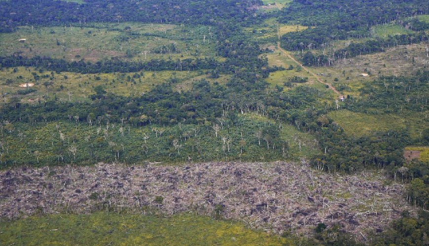
Seen from 2,400 feet above, Guaviare ceased to be an area on the map of Colombia and became a living diagnosis of the impact of deforestation on the territory.
“The Amazon needs legislative power to prevent the damage that is being done to it,” emphasized Geiny González as she disembarked from the aircraft in which she had taken an aerial tour of the department.
The advisor to the Technical Legislative Unit (UTL) of Representative William Aljure was one of 20 people who participated in the flyovers organized by IRI Colombia, one of the most revealing and impactful moments of the Scientific Immersion Day in the Amazon.
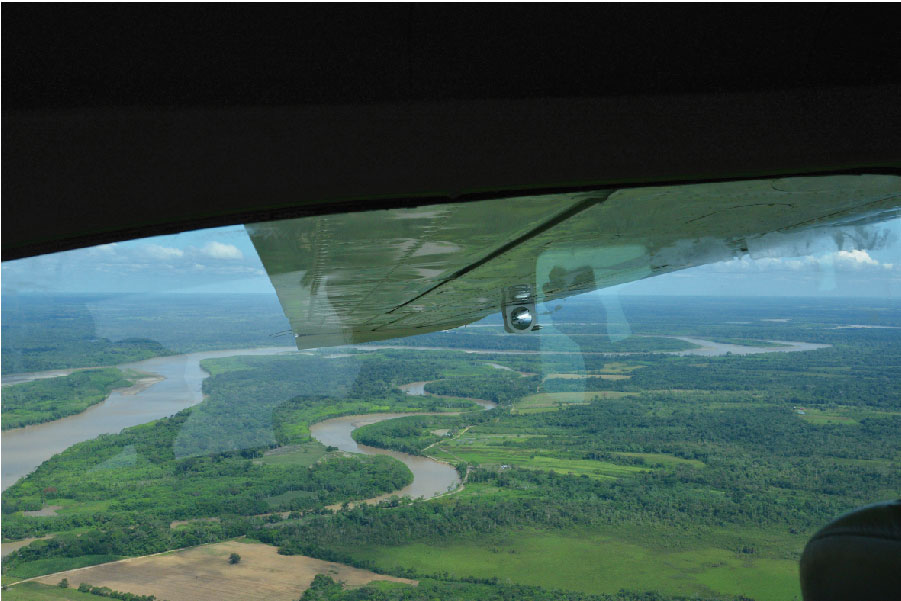
Aboard Cessna 210 light aircraft, members of Congress and the high courts, academics, national and international media, representatives of Colombian scientific institutions, and religious organizations had the opportunity to take part in this aerial journey, which was not designed to admire the landscape but to understand the territory in all its complexity and fragility.
For an hour and a half, they traveled across the department from north to south and flew over San José del Guaviare, El Retorno, and Calamar, municipalities that for years have had the highest rates of deforestation.
The aircraft departed from Jorge Enrique González Airport in San José del Guaviare, heading for the Guanapalo area near the village of Charras, one of the centers of deforestation that the government hopes to transform into a center of forestry development.
From there, the planes headed south, flying over the so-called cattle trail that connects San José del Guaviare with Charras Boquerón to the Guaviare River. Seen from above, this trail appeared as a fracture line where, in some sections, only small, disconnected patches of forest remain.
“This area has been occupied since the 1960s. It was one of the first areas to be deforested,” recalled Bernardo Giraldo, a researcher at the Sinchi Institute and one of the scientists who led the flyovers.
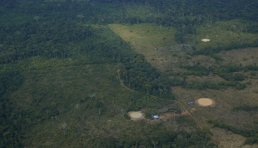
Further south, the deforestation front becomes more aggressive: traces of cattle ranching appear within the Nukak Makú indigenous reserve and intensify in the direction of Calamar.
“We were able to see the vast expanse of the Amazon, but also the traces of deforestation and illegal mining. It is very sad to see how livestock farming has advanced, reducing the amount of forest, and how illegal mining is putting pressure on the Nukak territory,” said Johanna Cortés Nieto, assistant judge of the Constitutional Court.
X-ray of deforestation
According to IDEAM, between 2017 and 2024 Guaviare lost more than 193,000 hectares of forest, and Calamar is a critical point of deforestation due to the increase in forest loss rates reported in recent years.
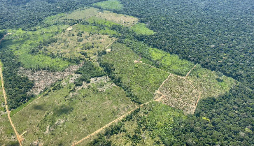
Upon reaching this municipality, the planes headed north. During this final segment of the journey, older areas of colonization and different ecosystems were observed, such as the Serranía de La Lindosa, where the jungle still offers resistance, but forest fragmentation is emerging as a threat.
“The connectivity of the Amazon region with the Andean region, which is also highly biodiverse, is being affected, as is the Orinoquía region. The loss of connectivity puts genetic diversity flows at risk, which is serious for ecosystems,” said Sandra Castro, a researcher at the Sinchi Institute, an organization in charge of three forest development centers in Guaviare: Charas, Cuba, and Nueva York, and Miraflores.
The IRI Colombia flyover revealed three realities that converge in the same territory: areas of forest still standing, essential for ecological connectivity; areas in transition, where intervention is beginning to take hold; and highly degraded deforestation centers.
These observations made it possible to identify not only the loss of forest cover, but also the structural drivers behind landscape transformation, such as livestock farming, the conversion of forest into pastureland and land speculation, the opening of roads, illegal mining, among others.
“This initiative by IRI Colombia allows us to learn about and understand the complexity of the phenomena, so that we can come up with solutions and make decisions that are in line with all interests and all aspects of the problem,” said Johanna Cortés Nieto, assistant judge of the Constitutional Court.
In turn, Blanca Lucía Echeverry emphasized that these flyovers were not a logistical exercise or a tourist visit to the region. “They were an act of radical awareness,” emphasized the director of IRI Colombia.
 Jugde Johanna Cortés, of the Constitutional Court; Vivian Olarte, of the UNGRD; Sandra Copete, advisor to the UTL of Senator Carlos Guevara; Enrique Rosales, of the CDA; and Gabriel Pérez, of CEDECOL.